By DeadSea.com Editorial
Last reviewed: September 2026
Dead Sea history has several clocks. Tectonic movement shaped the basin over millions of years. Lake Lisan expanded and retreated over tens of thousands. People used springs, routes, salt, bitumen, farmland, and fortresses over millennia. Manuscripts copied around the turn of the era were discovered in 1947. Ongoing water decline is now changing the shore within decades.
This overview is the thematic hub. Use the Dead Sea historical timeline when sequence is the main question, and follow the focused guides here when one place, text or period matters more.
Before human history: basin, lakes, and salt
The Dead Sea lies within a tectonic pull apart basin along the Dead Sea Transform. The fault system evolved over a very long period, so the lake does not have one defensible three million year birthday. Basin formation, predecessor lakes and the present body of water belong to related but distinct stages.
During the late Pleistocene, Lake Lisan occupied a much larger stretch of the Jordan Rift Valley. Its level changed with climate and watershed supply. Near the end of the last glacial period, it retreated, leaving deposits and shore evidence throughout the region. The present-day Dead Sea formed within the remaining deep basin.
The lake is terminal, meaning water enters but does not flow onward to an ocean. Evaporation removes water and concentrates dissolved salts. That physical system made brine, bitumen, salt deposits, and mineral resources part of later human history.
The Dead Sea environment explainer covers the water budget and the terminal basin.
The Dead Sea size tracker distinguishes surface area, depth and water level using dated measurements.
The Dead Sea is ancient, but not unchanging. Basin movement, climate, inflow, evaporation, and human water use have repeatedly altered what the lake looked like. History here begins with change, which is why a single origin date or timeless shoreline cannot carry the full story.
Early communities and valuable resources
Freshwater springs and routes made the margins of the basin usable even though the brine itself could not support agriculture or drinking. Archaeological sites around Jericho, Ein Gedi, and the southern basin show long settlement histories, but each site has its own chronology. The region was not one continuous city or culture.
Bitumen that surfaced from the lake became a traded material in the ancient Mediterranean. It was used in several technologies and became associated with Egyptian mummification in later periods. The Greek name Lake Asphaltites reflected this striking resource.
Balsam cultivation around Jericho and Ein Gedi also gained exceptional value. Ancient writers describe royal and commercial interest in the groves. Salt and other minerals mattered too, although today’s industrial production should not be projected backward as one unchanged ancient business.
Ein Gedi Nature Reserve combines the spring landscape with archaeology and explains current access to the oasis.
The Ein Gedi ancient synagogue profile follows the later community visible in the mosaic and remains.
Biblical landscapes and the limit of identification
Biblical texts use names translated as the Salt Sea, the Sea of the Arabah, and the Eastern Sea. Stories and poetry place the region beside kingdoms, wilderness routes, Ein Gedi, and the cities of the plain. These references created a powerful sacred geography that still shapes travel.
Tradition locates Sodom and Gomorrah near the southern basin, and Mount Sodom takes its present name from that association. Archaeologists have studied Bronze Age sites in the wider region, but no consensus allows us to identify one ruin as proved biblical Sodom.
The Sodom and Gomorrah guide separates text, proposed geography, archaeology and later tradition.
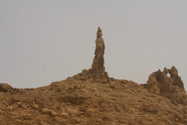
The Mount Sodom guide explains the real salt diapir without presenting a natural pillar as a confirmed person from a story.
First Samuel connects David’s flight from Saul with the wilderness of Ein Gedi. The landscape makes the text easier to imagine, but a present-day cave label cannot prove one exact refuge. The Dead Sea Bible history guide applies this evidence boundary across the region.
Sacred tradition is part of Dead Sea history even when archaeology cannot prove one exact location. The honest task is to show what a text says, where later communities placed the memory, what material evidence survives, and where those lines do not fully meet.
Hellenistic and Roman power around the lake
The late Hellenistic and Roman periods left some of the most visible sites. Hasmonean rulers and Herod the Great expanded Masada as a fortified royal complex above the western shore. Its palaces, storerooms, baths, water system, and defensive position speak to elite power and desert engineering.
During the First Jewish Revolt, rebels occupied Masada. Roman forces built camps, a circumvallation wall, and a siege ramp. Josephus provides the main literary narrative for the end of the siege, while archaeology supplies a different type of evidence. A responsible account compares them rather than treating every dramatic detail as independently verified.
The Masada visitor guide covers current access, tickets and route conditions.
The King Herod and the Dead Sea profile follows the ruler’s regional building program.
Classical authors also described the lake’s density, bitumen, and surrounding products. Their observations combine empirical detail, reported stories, and the literary conventions of their time.
Qumran and the Dead Sea Scrolls
The manuscripts now known as the Dead Sea Scrolls were copied from roughly the third century BCE through the first century CE. The collection contains manuscripts of Hebrew Bible books, community and legal works, prayers, hymns, interpretation, apocalyptic writing, and other Jewish compositions in Hebrew, Aramaic, and Greek.
The first discovery became known in 1947. Further searches identified fragments and manuscripts in eleven caves near Qumran. The Israel Antiquities Authority describes more than 900 manuscripts represented by tens of thousands of fragments. That is more accurate than imagining 972 intact scrolls.
The exact relationship between the Qumran settlement, cave deposits, and the people behind the library remains debated. The Essene identification is influential, but it should not be presented as the only possible scholarly conclusion.
The Qumran visitor guide covers the settlement, water system and cave landscape.
The Dead Sea Scrolls overview explains the collection and its contents.
The Old or New Testament guide answers the separate canon question.
Individual works reveal the collection’s variety. The War Scroll presents an apocalyptic conflict plan rather than a historical battle report.
The biblical history article puts those manuscripts into a wider, carefully separated account of scripture, tradition, archaeology, and geography.
Pilgrimage, monasteries, and later rule
Christian pilgrimage reshaped the Jordan Valley and Judean Desert during late antiquity. Churches, monasteries, hermitages, and baptism traditions developed around sacred routes and the lower Jordan. The landscape’s remoteness drew communities seeking withdrawal, discipline, and proximity to biblical memory.
Qasr al Yahud on the western bank carries the baptism tradition within a currently managed border site. The eastern bank destination in Jordan is separate. Their proximity across the river does not create shared access.
Islamic, Crusader, Mamluk, and Ottoman periods each changed regional administration and travel. Local communities continued to use springs, agriculture, grazing, and routes even when European accounts described the basin as empty. “Remote” in a travel narrative is not the same as uninhabited.
Nineteenth century expeditions added systematic mapping, sounding and chemical observation. Their records matter because they capture an earlier water level and scientific method. They should be read historically, not used as today’s dimensions.
These surveys also changed how the Dead Sea entered global knowledge. Earlier writers often repeated inherited claims about objects floating, birds avoiding the lake, poisonous vapors, or ruined cities. Surveyors increasingly compared instruments, positions, soundings, samples, and routes. Their work was not free of the political assumptions of their period, but it created records that can be checked against later measurements.
Photography and archaeology added further layers. Images preserved former shorelines and buildings, while excavation turned Masada, Qumran, and Ein Gedi into interpreted visitor sites. Interpretation itself has a history: labels, national narratives, religious expectations, and new research can change how the same stones are presented.
Industry, states, and contemporary tourism
Commercial mineral production expanded during the British Mandate. The Palestine Potash Company began operating around the start of the 1930s. War and political division disrupted the early system, after which Israeli and Jordanian industries developed separately.
Today, Dead Sea Works and the Arab Potash Company use managed evaporation ponds across much of the former shallow southern basin. These ponds are economically important and physically distinct from the deep natural northern lake. They also form part of the current water budget.
Tourism developed through two country systems. On the Israel side, the Ein Bokek resort zone expanded beside the southern pond system. On the Jordan side, hotels and day access developed around Sweimeh and the eastern shore.
The contemporary “health resort” story also needs a boundary. The climate and brine attracted medical research and supervised treatment programs, but evidence from one condition, exposure protocol or clinical setting does not prove that every float, mud product or hotel spa is therapeutic. Tourism history can record the reputation without turning it into medical advice.
The Ein Bokek article follows the western resort area’s local development and visitor context.
The Sweimeh article covers its separate eastern-shore history in Jordan.
Use the Israel Dead Sea overview for routes, beaches, and stays on the western side.
Use the Jordan Dead Sea overview for the distinct eastern-shore network. Do not mix hotels and transport across them.
The environmental crisis becomes history
The Dead Sea always fluctuated, but twentieth century water management created a rapid decline. Diversion of Jordan River basin water greatly reduced inflow. Industrial pumping into evaporation ponds added another large demand. Climate influences the balance, but it should not become a vague substitute for the direct water budget.
On 4 October 2026, the Israel Water Authority measured the surface at 441.50 metres below mean sea level. A 2026 remote sensing study mapped about 592.37 square kilometres for 2022, compared with about 1,019.33 square kilometres in 1971 under the same study’s method.
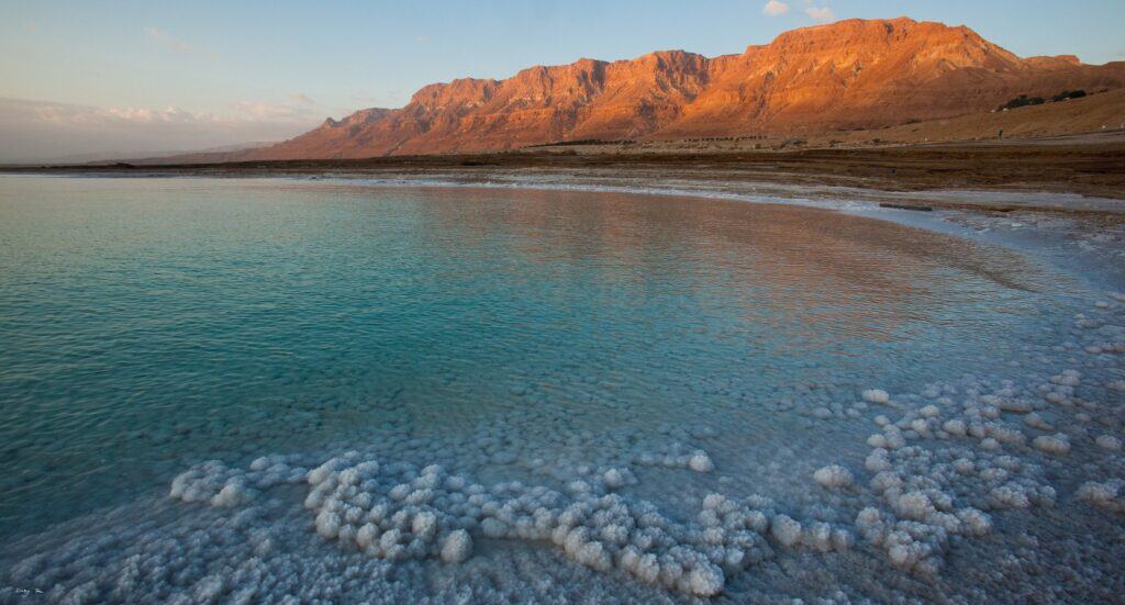
Retreat exposes former lakebed, lengthens beach access, and changes groundwater flow through buried salt. In affected zones, dissolving subsurface salt creates cavities and sinkholes. Former roads, beaches, and facilities have closed or moved.
The Dead Sea water level tracker follows the official gauge series and keeps dates beside measurements.
The salt formations article explains what crystallization and exposure reveal. No proposed conduit should be placed in history as a successful rescue unless it is built, operating, and independently shown to affect the level.
The environmental crisis is not an epilogue outside history. Water policy, industry, roads, resorts, closed beaches, sinkholes, and a moving shoreline now shape how people live with the Dead Sea. The landscape seen by one generation can differ materially from the landscape remembered by the previous one.
How to visit the history rather than rush past it
Choose one historical theme for a day. For archaeology and the Roman period, pair Masada with a managed southern beach. For manuscripts and Second Temple Judaism, make Qumran the anchor. For biblical landscape and spring settlement, choose Ein Gedi and its antiquities.
Do not force Qasr al Yahud, Qumran, Ein Gedi, Masada, and a float into one itinerary. Current reservations, heat, route difficulty, and lifeguard periods matter. Use things to do at the Dead Sea to choose one companion stop.
The first time visitor article explains the water sequence and the practical checks to make before entering.
Read the site authority’s current notice before departure. History does not make a trail, monastery compound, cave, or receded shore open. Preserve the place by remaining on signed routes and leaving salt, plants, manuscripts, and archaeological material where they belong.
Frequently asked questions
How old is the Dead Sea?
The basin developed over millions of years, but the present lake is one stage in a sequence that includes larger predecessor waters such as Lake Lisan. There is no single precise birthday that applies equally to the fault basin, Lake Lisan and the current hypersaline lake.
What did ancient people call the Dead Sea?
Biblical texts use names translated as the Salt Sea, Sea of the Arabah, and Eastern Sea. Greek and Roman writers used names associated with asphalt or death. Each name came from a particular language and concern, so there was no single title used by every culture across time.
Did Cleopatra own the Dead Sea?
Ancient sources connect Cleopatra with valuable balsam and regional revenues granted through Mark Antony, but “owned the Dead Sea” is too broad. Political authority, commercial rights, territory, and personal product use are different claims. Her documented significance is commercial and political, not proof of a beauty routine.
Who wrote the Dead Sea Scrolls?
The manuscripts came from multiple scribes and were probably collected from more than one origin. A community associated with Qumran likely played an important role, and many scholars connect it with Essenes. The precise authorship, ownership, and deposit history remain debated across the collection.
When did large-scale industry begin?
Large commercial mineral production developed during the British Mandate, with the Palestine Potash Company operating around the start of the 1930s. Separate Israeli and Jordanian industries later expanded the southern evaporation pond system. Ancient salt and bitumen trade was an earlier and different economic activity.
Why is the Dead Sea shrinking now?
Current inflow no longer balances evaporation and industrial pumping. Diversion of Jordan River basin water for municipal and agricultural use is central, while mineral production and climate also affect the balance. Exact responsibility percentages require a defined period and transparent model.