Overview
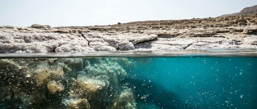
The Dead Sea’s shoreline is the lowest exposed land on Earth. On 4 October 2026, the Israel Water Authority measured its surface at 441.50 metres below mean sea level. The level changes, so an undated elevation will eventually become wrong; the Dead Sea water-level guide follows the longer record.
The current Dead Sea elevation
The Israel Water Authority series reported a level of minus 441.50 metres on 4 October 2026; the previous published measurement was minus 441.48 metres on 30 September 2026.
Those figures describe the water surface relative to mean sea level. They do not describe the depth of the water or the depth of the geological basin beneath its sediment. Keeping those three ideas separate prevents a common error.
| Measurement | What it means | Current or reference figure |
|---|---|---|
| Water-surface elevation | Height of the lake surface relative to mean sea level | Minus 441.50 metres on 4 October 2026 (Israel Water Authority) |
| Water depth | Distance from the surface to the lakebed at a measured point | Approximately 280 metres in Mor et al. (2025), citing the 2014 bathymetric map; not a live measurement |
| Geological basin depth | Depth of the sediment-filled tectonic basin | Several kilometres, far below the lakebed |
Why is the Dead Sea so low?
The lake occupies the Dead Sea basin, a pull-apart basin along the Dead Sea Transform. This plate boundary separates the Arabian Plate from the Sinai subplate, which moves with the African Plate; sideways movement along faults also created zones where the crust stretched and the basin subsided.
Geological studies place the start of the Dead Sea basin around 15 million years ago or earlier, close to the early development of the transform system. Sediment then accumulated as subsidence continued. The present lake occupies only the water-filled upper part of a much deeper geological structure.
The guide to how the Dead Sea formed follows that history in detail. For a visitor, the simple version is enough: tectonics made a deep closed basin, and evaporation helped concentrate the water that remained.
Why does the exact elevation keep changing?
The Dead Sea is a terminal lake. Water can flow into it, but there is no river outlet to the ocean; its level reflects the balance among inflow, rainfall, evaporation, and human water use in the basin.
The Water Authority’s dataset records monthly measurements rather than one permanent number, and the series shows a long decline. Regional research links that decline to sharply reduced inflow and industrial pumping on the Israeli and Jordanian sides; a single month’s change is not an annual rate, because seasonal and short-term movement can differ from the longer trend.
About 441 metres below sea level gives a useful general orientation; the exact figure needs its measurement date. The Dead Sea environmental guide explains how the changing shoreline affects the surrounding region.
What is the difference between elevation and depth?
Elevation starts from mean sea level and measures downward to the Dead Sea surface; water depth starts at that surface and measures farther down to the lakebed, while Mor et al. (2025), citing the 2014 bathymetric map, describe a maximum water depth of approximately 280 metres. The exact depth depends on the lake level and the date of the bathymetric reference. Adding that depth to a current surface elevation gives an approximate lakebed elevation, but it should not be turned into a false permanent figure.
The approximately 280-metre reference used by Mor et al. (2025) describes the northern lake.
The tectonic basin is deeper still. Geophysical research describes several kilometres of sediment filling the pull-apart structure. That is why “lowest shoreline,” “deep lake,” and “deep basin” are related statements but not interchangeable ones; the shore is low because the lake surface sits more than 441 metres below mean sea level.
The Elevation Drop: A Physical Experience
Elevation is also separate from chemistry. The Dead Sea salinity guide explains the concentrated brine, while the Dead Sea versus ocean comparison shows why a low surface does not by itself explain density, mineral composition, or the unusual floating experience.
What will visitors notice on the way down?
Roads from the surrounding highlands descend past the sea-level line and continue into the basin. The change is easy to see on a map and in the landscape: pale cliffs rise above the road while the destination remains far below the Mediterranean reference level; air pressure is higher at this elevation than at sea level.
The thicker atmospheric column also changes ultraviolet exposure, but it does not remove the need for sunscreen or create a general medical benefit. Low elevation alone does not prove a health benefit.
The basin can be much hotter than Jerusalem and other highland starting points. Check the current Dead Sea weather and any heat or flood notices before leaving.
At the shore, follow the Dead Sea safety guide and drink water regularly, as the regional beach authority advises.
Where can you understand the elevation on a visit?
The descent itself is the clearest demonstration. Travelers approaching from Jerusalem pass from the highlands into the Jordan Rift Valley and continue down toward the shore. On the Israeli side, Masada and the western escarpment provide broad views across the basin; on the Jordanian side, the Dead Sea Panorama Complex interprets the landscape from above the shore.
Choose the country first, then plan within that side; the first-time visitor guide covers the broader trip. The geology spans the whole basin, but roads, sites, fees, and operating rules differ between Israel and Jordan.
What This Means for Visitors
FAQs
What is the Dead Sea elevation right now?
The latest official measurement available for this update was minus 441.50 metres on 4 October 2026 (Israel Water Authority); that means the water surface was 441.50 metres below mean sea level. Check the measurement date whenever you quote the number, because the level changes.
Is the Dead Sea the lowest point on Earth?
Its shoreline is the lowest exposed land shoreline on Earth. Deeper points exist beneath oceans and inside mines, but those are different categories; the Dead Sea claim concerns an exposed continental shoreline and the adjacent lake surface, which stood 441.50 metres below mean sea level on 4 October 2026.
How deep is the Dead Sea?
Mor et al. (2025), citing the 2014 bathymetric map, describe a maximum water depth of approximately 280 metres. This is a reference figure, not a live reading. That measurement starts at the lake surface and runs to the deepest lakebed area. It is separate from elevation, which starts at mean sea level, and from the much deeper tectonic basin beneath the accumulated sediment.
Why is the Dead Sea below sea level?
It lies in a pull-apart basin formed along the Dead Sea Transform; movement between the Arabian Plate and the Sinai subplate created subsiding basins that later filled with sediment and water. Because the lake has no outlet to the ocean, its surface can remain far below mean sea level.
Does low elevation make Dead Sea sun exposure safe?
No. The atmospheric column differs from sea level and affects the ultraviolet spectrum, but visitors still need sun protection and current heat guidance. Low elevation should not be treated as a medical benefit or a reason to extend exposure. Check the weather and follow local beach instructions.